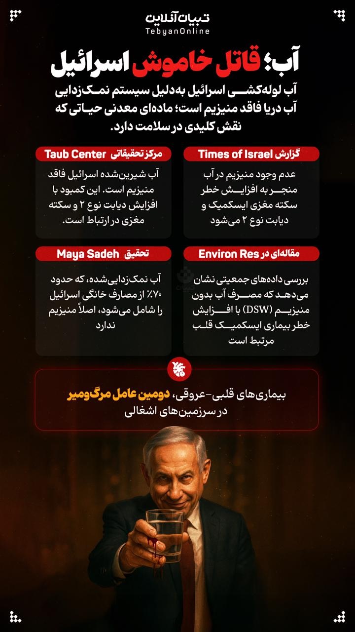
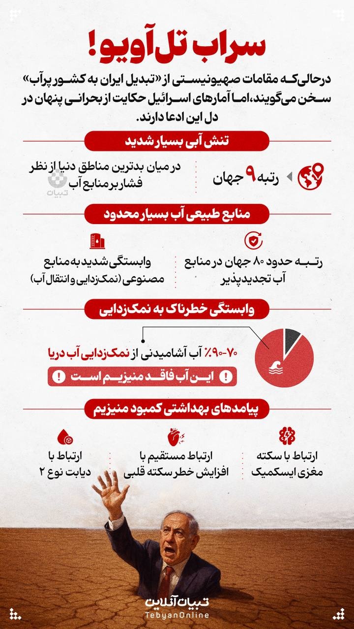
• Counter :
  • 1663
  • Date :
  • 7/14/2009

The Province of Kohkiluyeh & Boyer Ahmad

the province of  kohgiluyeh  & boyer ahmad

Geographical Position

The province of Kohgiluyeh & Boyer Ahmad with an area of 15,563 square kilometers is located in central southwestern Iran. Based on the latest divisions of the country in 1996, the cities of this province are as follows:

Kohgiluyeh (with its center as Dehdasht), Boyer Ahmad (with its center as Yasooj) and Gachsaran. Yasooj is the provincial capital. This province is limited in the north by the province of Chahar Mahal & Bakhtiyari, and in the south are the provinces of Fars and Bushehr. In the east the provinces of Esfahan and Fars and to the west it is in the neighborhood of Khuzestan province.

In 1996, this province has a population of 544,000. Out of this 39.2% lived in the urban and 60.2% lived in the rural areas. The remaining being non-residents.

Climate

The province of Kohgiluyeh & Boyer Ahmad is a mountainous region. Approximately 45% of it comprises of hills and mounds and the remaining 15% is in the plain.

The highest point of this province is the Dena summit with a height of 4.409 meters and the lower part of this area being 500 m, above sea level. In cold regions the heights are higher, as well as the mounds. In the warmer regions, these heights are lower.

Most of the agricultural lands of this province are located in the plains. The Zagross Mountain Ranges stretch from the northeast to the southwest of Kohgiluyeh & Boyer Ahmad province, and in the heights, the amount of precipitation decreases, bringing about two types of climate. These are the cold and tropical regions.

The tropical region is located in the southern and western parts of the province, enjoying a hot and dry climate with seasonal winds. The rain begins from October and ends in April. Freezing weather is rarely seen in this area. The colder region is to the north and east part of the province where the rainfall begins in October and ends in April. At times snow fall is seen in the region. This part of the province, which is located at the southern most part of the Zagross, has humid weather and its forests are covered with oak trees. Plenty of lakes and rivers flow in this region. Winds blowing in this region are as follows:

the dena summit

Seasonal winds are reputedly known as the north and south winds. The north winds usually blow from the Mediterranean and Atlantic Ocean influencing rainfall. Whereas, the south winds blow from the south and southwest are active at the end of spring and summer in the region, and are usually accompanied by heat. 

Local winds blowing in different areas, to a lower extent. The most important ones are as follows: The Ashob, Zing Rooz, Kooh, Heyran, Chowgan, Ou and Darakhtroo winds.


Other links:

History of Khuzestan (part 1)

History of Khuzestan (part 2)

The Province of Lurestan

The Province of Ilam

Province of Kurdistan

  • Print

    Send to a friend

    Comment (0)